


Know the ground before you go.
Topo maps, printable UTM sheets, mission plans and radio coverage, drawn from your own copy of the data. Plan at the desk, carry it into the field.
See every tool at work.
The same tools you use in the app. Pick one to see it on the map, and which plan includes it.
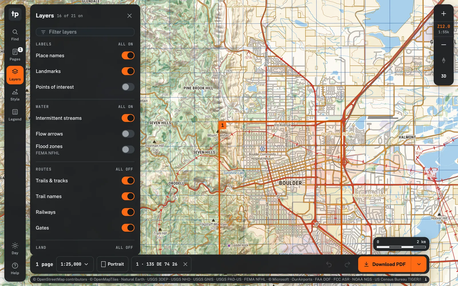
Offline topo maps
Detailed topographic maps built from public data, drawn on your screen with no outside calls.
- Topo base map with hillshade, contours and 3D terrainFree
- Public land, flood zones, tree canopy, buildings, towers and obstaclesFree
- Motor vehicle use roads and trails by vehicle class and seasonFree
- Layer groups, map styles and a pinned legendFree
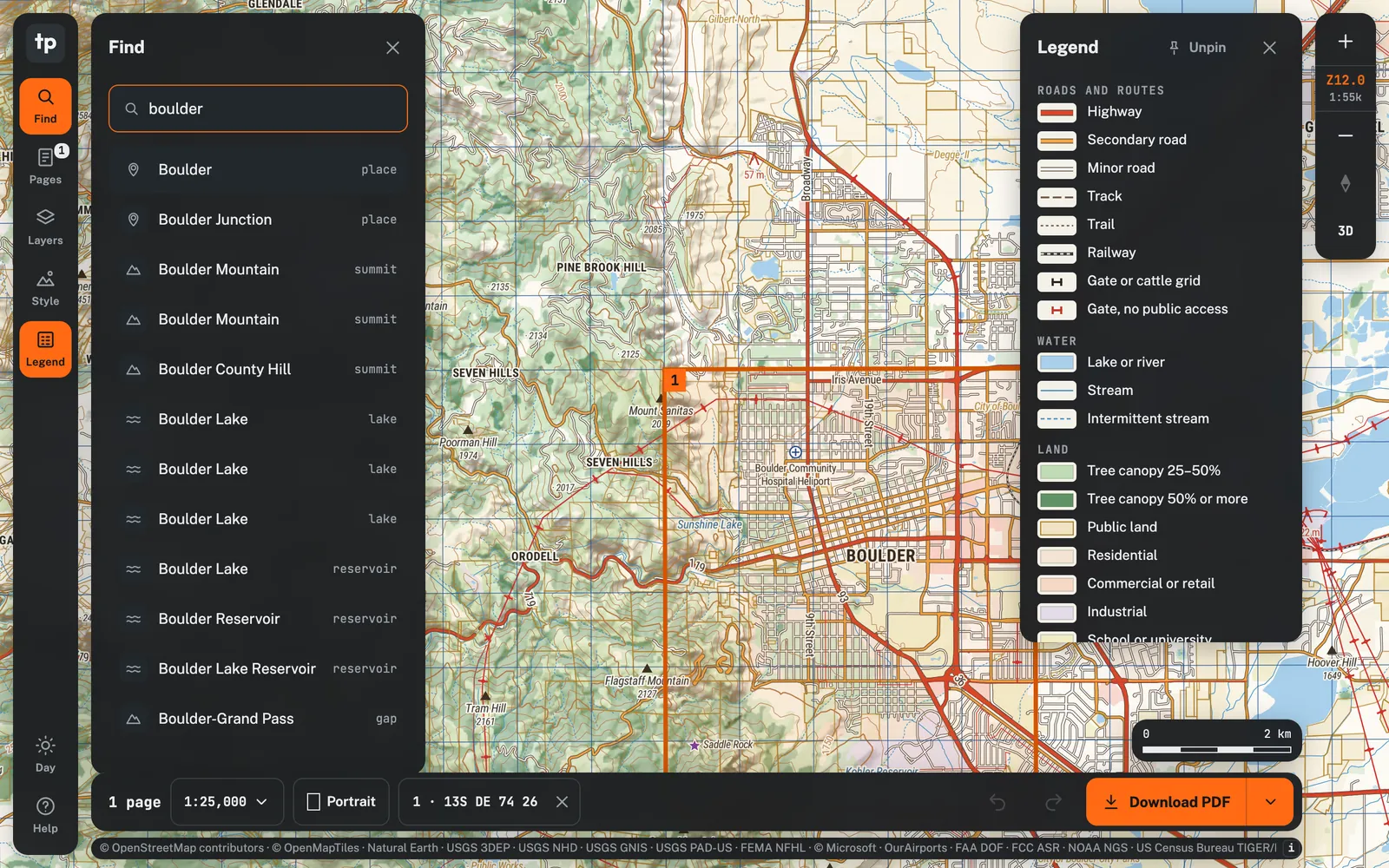
Find
Jump to a place or a grid reference in one box.
- Towns, peaks, lakes and landmarksFree
- MGRS, UTM and lat/lon coordinatesFree
- Street addresses and house numbersField
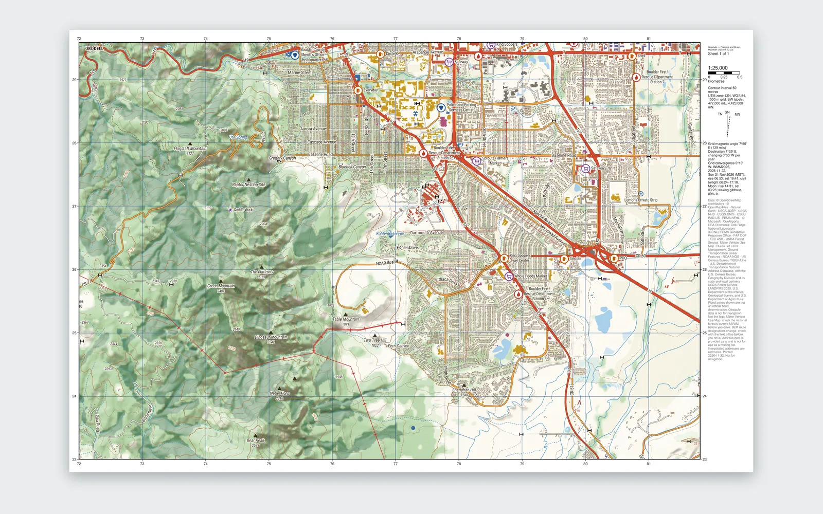
Print and export
Paper maps that line up with the UTM grid, and files for the devices you carry.
- PDF sheets at 1:15k, 1:24k, 1:25k, 1:48k or 1:50kFree
- Letter to tabloid, A5 to A3, or any custom paper sizeFree
- Grid, declination diagram and data credits on every sheetFree
- KMZ for Garmin handhelds, and share linksFree
- ATAK MBTiles and vector area exportField
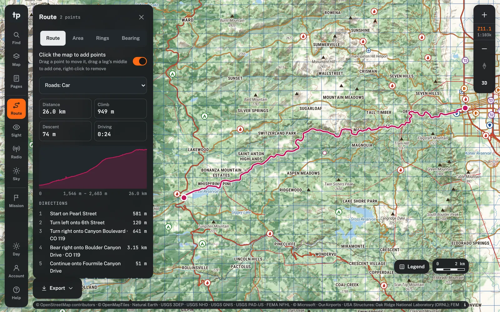
Route and measure
Distances, bearings, profiles, and road routes that work with no signal.
- Lines, areas, range rings and bearings in degrees or milsField
- Elevation profile for every legField
- Offline road routing for foot, car, 4x4, ATV and motorcyclePro
- Turn lists with seasonal closure warningsPro
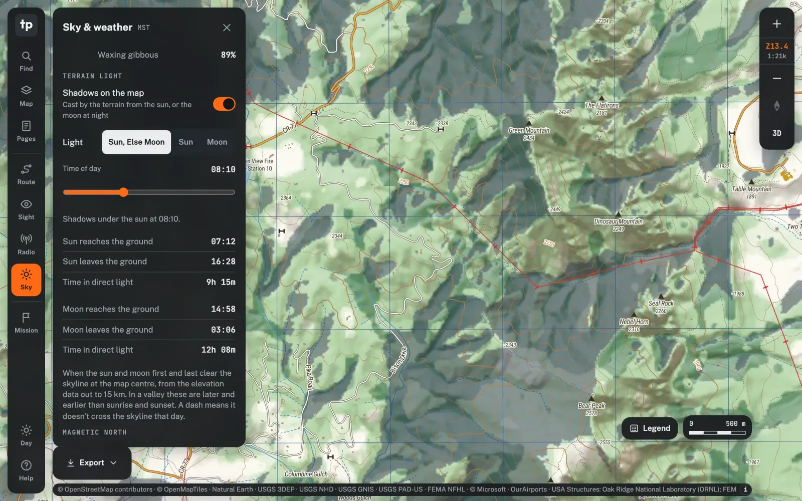
Sky and sight
Know where the light falls and what can be seen from where.
- Sun and moon times for any dayField
- Terrain shadows at any hour, from the sun or moonField
- Line of sight and viewshedField
- Night and red light modesField
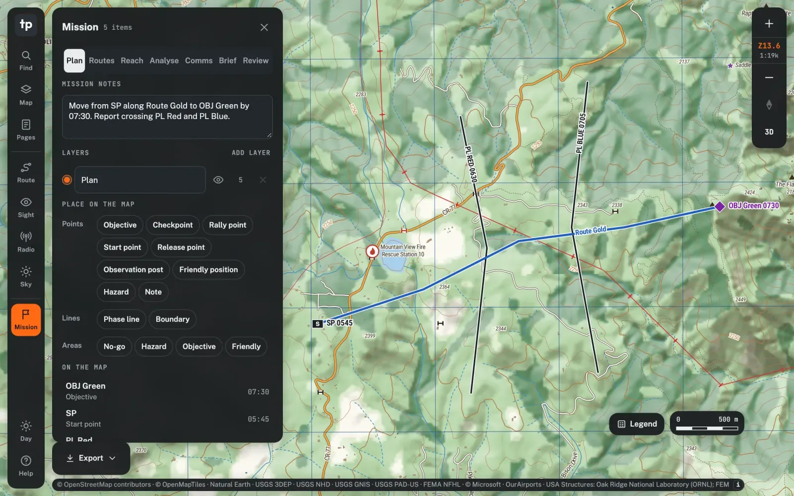
Mission planning
Build the whole plan on the map, then hand out the packet.
- Phase lines, objectives, routes, alternates and timelineField
- PACE comms plan and mission notesField
- Suggested foot routes, Reach on foot and HLZ searchField
- Water, resupply, hidden movement and drone launch sitesField
- GPX, KML and KMZ import, version history and after-action replayField
- Mission packet PDF, KML and ATAK data packageField
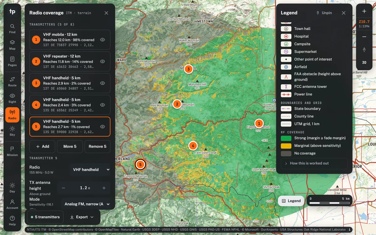
Radio coverage
See where a radio reaches before you climb the hill.
- Coverage maps from terrain and ground clutterPro
- VHF/UHF business, Wi-Fi HaLow and 2.4 GHz presetsPro
- Drive tests, comms along a route and a relay finderPro
- 10 m radio terrain where the state has itPro
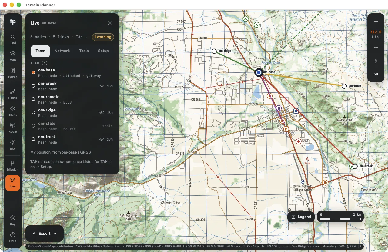
Desktop and mesh
The full app on your laptop, with offline map packages and your OpenMANET mesh.
- Mac, Windows and Linux app with downloadable map packagesPro
- Plan sync between laptops on your networkPro
- Live OpenMANET mesh, your position and breadcrumbsPro
- TAK link and measured versus predicted radio linksPro
- Plans saved to your account on every deviceSoon · Pro
- Weather on the webSoon · Pro
No connection. No problem.
The desktop app runs the whole planner from your own disk. Download map packages once and take them anywhere.
- Updates download and install automatically
- Sync plans between laptops on your network
- Live OpenMANET mesh and TAK link on Pro
macOS
Windows
Linux
Pay once a year. Pro adds the desktop app.
Free $0 Look at the ground and print sheets. Request an invite | Field $49 / year Plan the route and the mission. Request an invite | Pro $99 / year Take it offline on the desktop, plan radios and run the mesh. Request an invite | |
|---|---|---|---|
| Offline topo maps | |||
| Topo base map with hillshade, contours and 3D terrain | |||
| Public land, flood zones, tree canopy, buildings, towers and obstacles | |||
| Motor vehicle use roads and trails by vehicle class and season | |||
| Layer groups, map styles and a pinned legend | |||
| Find | |||
| Towns, peaks, lakes and landmarks | |||
| MGRS, UTM and lat/lon coordinates | |||
| Street addresses and house numbers | |||
| Print and export | |||
| PDF sheets at 1:15k, 1:24k, 1:25k, 1:48k or 1:50k | |||
| Letter to tabloid, A5 to A3, or any custom paper size | |||
| Grid, declination diagram and data credits on every sheet | |||
| KMZ for Garmin handhelds, and share links | |||
| ATAK MBTiles and vector area export | |||
| Route and measure | |||
| Lines, areas, range rings and bearings in degrees or mils | |||
| Elevation profile for every leg | |||
| Offline road routing for foot, car, 4x4, ATV and motorcycle | |||
| Turn lists with seasonal closure warnings | |||
| Sky and sight | |||
| Sun and moon times for any day | |||
| Terrain shadows at any hour, from the sun or moon | |||
| Line of sight and viewshed | |||
| Night and red light modes | |||
| Mission planning | |||
| Phase lines, objectives, routes, alternates and timeline | |||
| PACE comms plan and mission notes | |||
| Suggested foot routes, Reach on foot and HLZ search | |||
| Water, resupply, hidden movement and drone launch sites | |||
| GPX, KML and KMZ import, version history and after-action replay | |||
| Mission packet PDF, KML and ATAK data package | |||
| Radio coverage | |||
| Coverage maps from terrain and ground clutter | |||
| VHF/UHF business, Wi-Fi HaLow and 2.4 GHz presets | |||
| Drive tests, comms along a route and a relay finder | |||
| 10 m radio terrain where the state has it | |||
| Desktop and mesh | |||
| Mac, Windows and Linux app with downloadable map packages | |||
| Plan sync between laptops on your network | |||
| Live OpenMANET mesh, your position and breadcrumbs | |||
| TAK link and measured versus predicted radio links | |||
| Plans saved to your account on every deviceSoon | |||
| Weather on the webSoon | |||
Billed yearly, no monthly plans. Checkout opens after early access; invited accounts get every Pro feature until then.
Before you ask.
What is Terrain Planner?
A topographic map and planning tool for the United States. It draws detailed topo maps from public data, prints UTM-gridded map sheets, plans routes and missions, and predicts radio coverage over the real terrain.
Does it work without a connection?
The desktop app on the Pro plan runs entirely from map packages on your own disk, with no connection at all. The web app needs a connection to app.terrainplanner.com and makes no calls to any other service.
Which map scales and paper sizes can I print?
PDF sheets at 1:15,000, 1:24,000, 1:25,000, 1:48,000 or 1:50,000, on US Letter, Legal or Tabloid, A5 to A3, or any custom size. Every sheet carries the UTM grid, a declination diagram and the data credits.
Can I use it with ATAK or a Garmin GPS?
Yes. Export KMZ map sheets for Garmin handhelds on any plan, and ATAK MBTiles, vector area exports and mission data packages on Field and Pro.
What does it cost?
Free costs nothing. Field is $49 a year and Pro is $99 a year. There are no monthly plans. While Terrain Planner is invite-only, invited accounts get every Pro feature.
How do I get access?
Request an invite with your email below. We send invites as space opens while we test it in the field.
Get on the list for an invite.
Terrain Planner is invite-only while we test it in the field. Leave your email and we will send an invite as space opens.
Request received. We will email when your invite is ready.